
Web
for spatial data review, without using third-party technologies


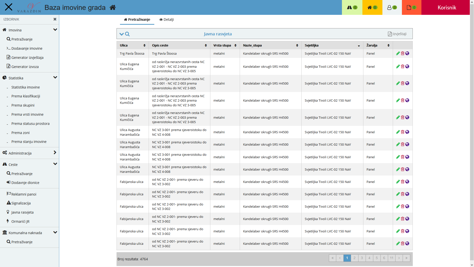
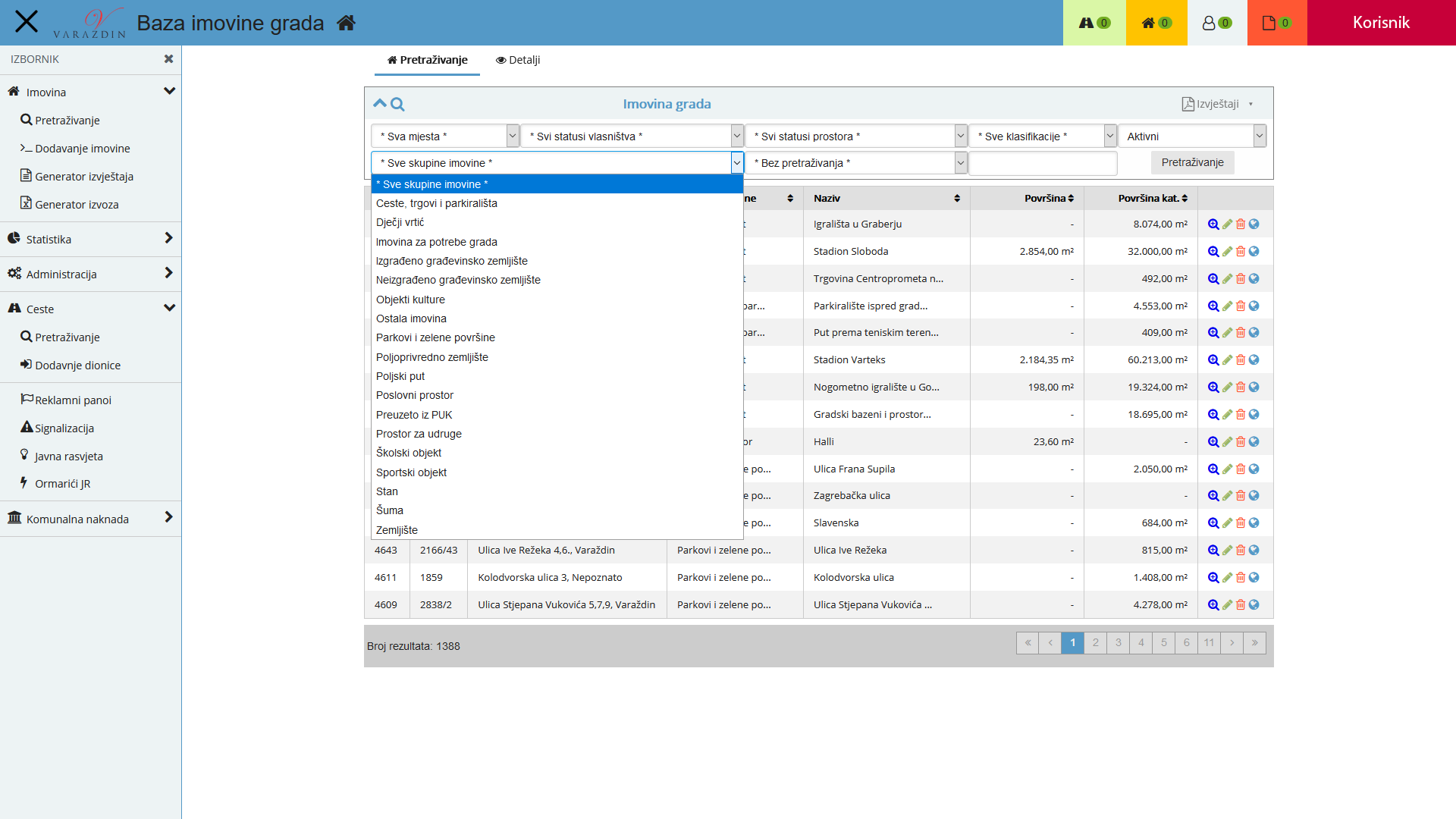
City Assets Base (BIG)
City Assets Base (BIG) is a unique information system in Croatia that enables recording, analysis and display of assets of local self-government units on geodetic bases. The system enables master data management, usage, cost and revenue data management for each asset unit, as well as fully user-defined reporting and analysis.
In this way, correct information on assets are available to public administration at all times. They can manage and direct their own resources to create new value and to improve their efficiency.
BIG is a web app developed in PHP. MySQL and Oracle databases are used. It is completely independent of platforms.
AJAX technology has been used due to its optimisation, robustness and performances. Reports are generated in PDF and Excel format and are platform- and software-independent. Therefore, it is possible to use them for distribution in a digital form, as a presentation or for publishing on websites.
The system has been developed based on an asset management model that was created within the local government reform project led by Urban Institute, in cooperation with local government units in Croatia, and it serves as a basis for effective and efficient application of new management techniques. This model implements a new system approach of increasing efficient use of assets owned by or available to local self-governments.
- Management of data on assets, active and expired contracts
- Management of data on regular and extraordinary costs related to assets
- Input of data on basic and support facilities
- History data review
- App users and codebook administration
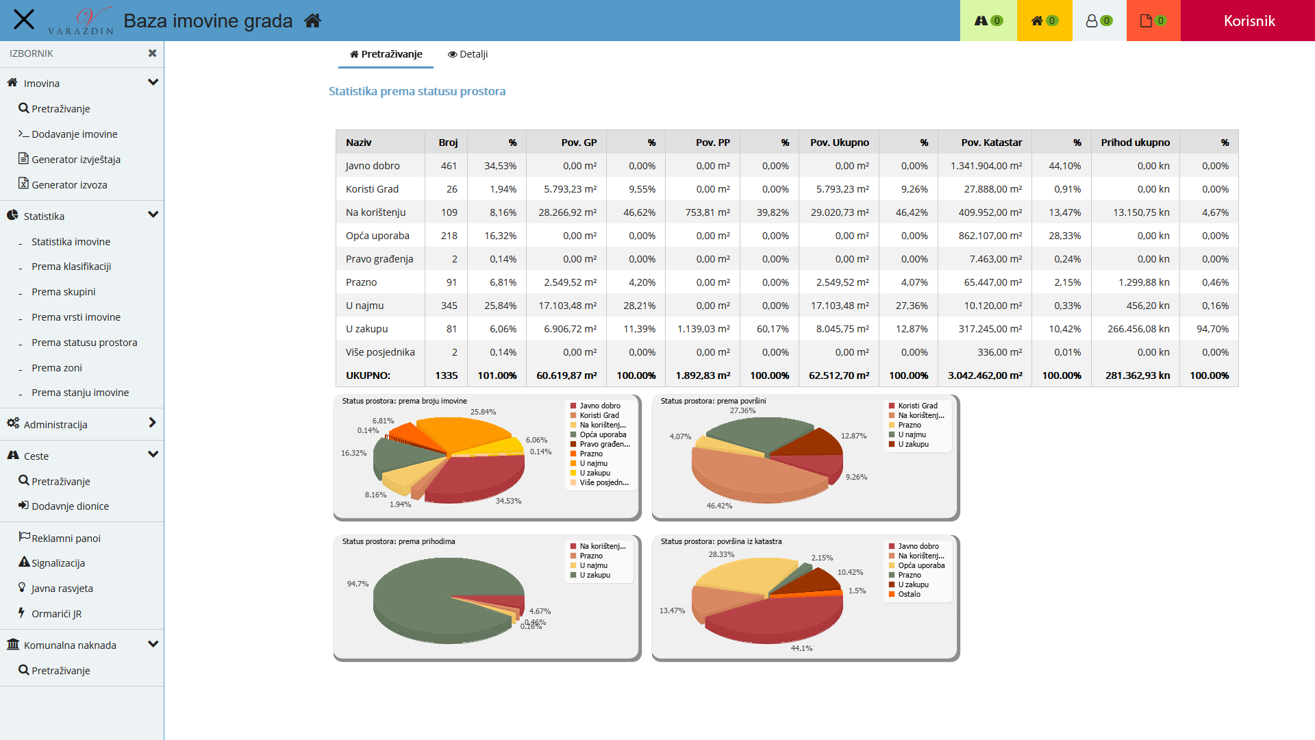
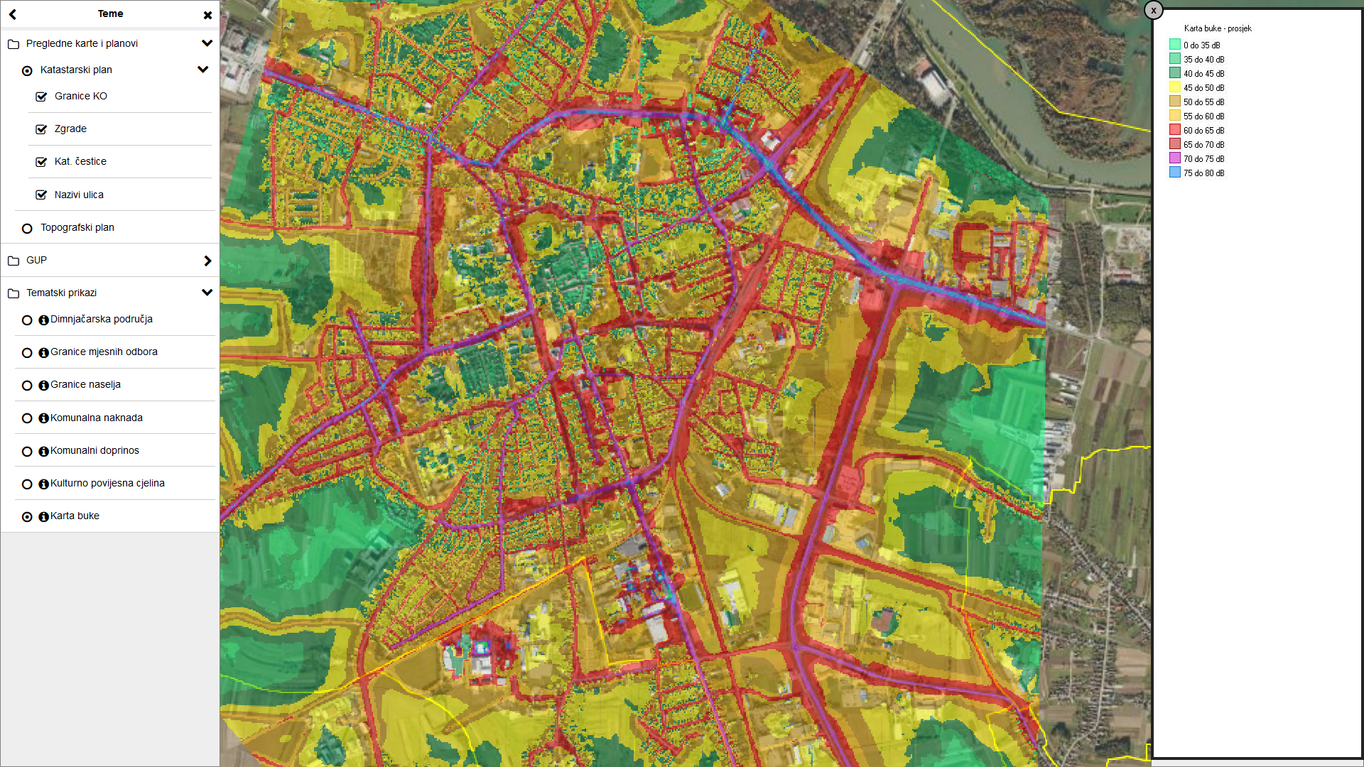
- Detailed statistics in tabular and graphical view (based on classification, asset group, asset type, facility status, zone, asset condition and communal infrastructure).
- Photo and document upload (contracts, drafts etc.) possible for each asset unit
- Data filtering based on various criteria
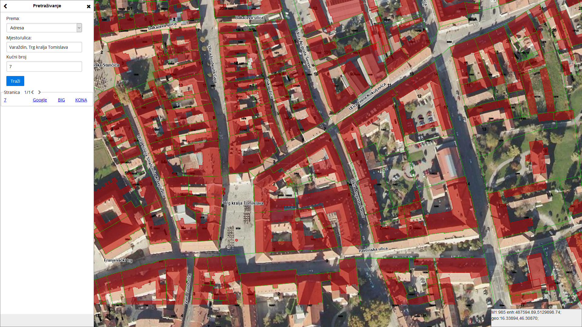
- Data search based on various criteria
- Report generator in which the user chooses the content of the report (PDF and Excel format)
- Pre-defined report generation in PDF and Excel format according to criteria set by the user (asset reports, contract reports, lists based on facility purpose etc.)
- Automatic generation of reports on empty facilities or apartments and contract expiration dates
- App notification on upcoming expiration date of the contract on commercial premises lease or apartment lease.
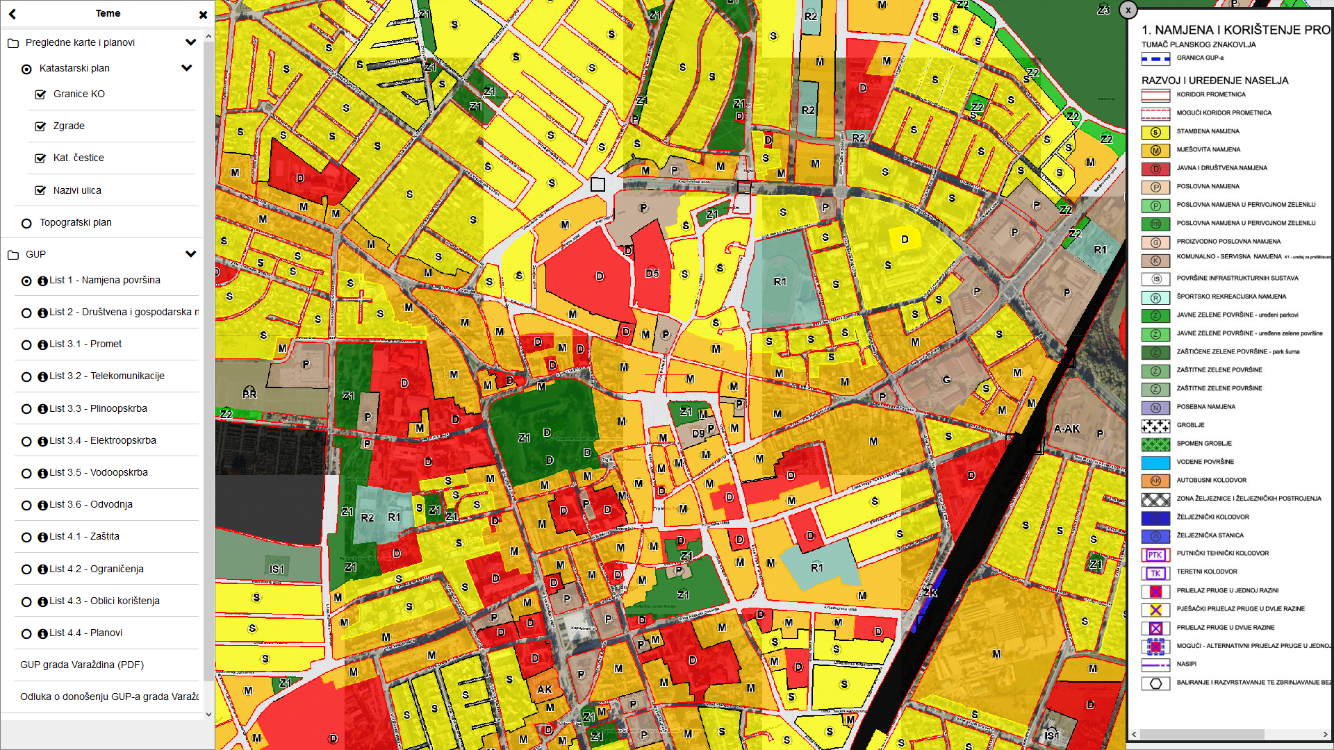
GIS
In 2008 Meritum Soft d.o.o. started developing and constructing GIS system aimed at city administration workers, who are the end users in terms of the access, analysis and maintaining current data on facilities and facilities layout plans. This is a stand-alone system that is using an existing platform and is communicating to already developed systems of other administrative departments of the city.
The system is also available as a public service for citizens, without a possibility to connect to city assets data.
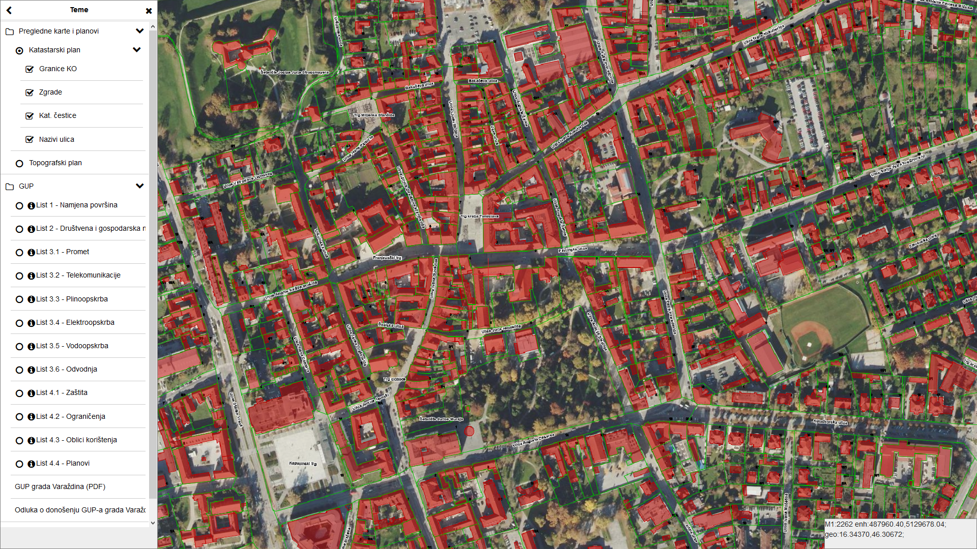
The system is based on a modern GIS technology with a database that will be developed by collecting and processing of their own data, external official data (State Geodetic Administration (SGA), Ministry of Justice, Ministry of Economy…), specially prepared existing external data (digital ortophoto, Croatian Basic Map (HOK), cadastral plan, topographic map) and public utility companies data related to their infrastructure.
System maintenance, updating of the system and any defined data exchange will be conducted to a large extent by applying the principle of interoperability through corresponding services.
The primary objective of the system was to enable relevant geodetic-technical and descriptive view of the city area in order to find out about the current situation in the area. Apart from that, the system enables display and analysis of the physical planning documentation and documentation on monitoring of the state of the area.
This solution is a web app, whereas Oracle SDO and MySQL Spatial are used as databases for spatial data.
It is important to emphasize that this product, as well as all our other products, is completely independent in terms of licensing and an exclusive product of our company.
The tool itself, in the form of a web app, incorporates most of similar tools for graphic content manipulation (vector and raster). In the process of developing the system, particular attention was paid to logic, simplicity and generally accepted actions (“standards”) of various products available in the market. All these features have been combined into one product.
Meritum’s GIS product range includes a variety of different functionalities:
- Importing vector content with standard dxf and shp files
- Editing and manipulation of imported files in the form of themes and layers
- Saving edited themes into databases as pre-defined themes and themes which users cannot change (read-only)
- Rearranging and combining content with pre-defined themes
- User account management and system user grouping, managing group permissions, individual accounts and user themes
- Simple graphical elements drawing (dots, text, lines, polygons) into user-defined layers and managing permissions in terms of using these elements
- Setting spatial queries by combining geometries of displayed content
- Geometry length and surface measurement
- Basic information on selected geometry (type, theme layer, length, surface)
- Browsing point (text) geometries, for example, cadastral parcel number or the address with a street number